Water Flows - MSLS Area of Maury County Park
Greetings Al Ray,
This webpage is designed to show you the rain water challenges we are encountering around the track site in Maury County Park. Some of these issues have been around a very long time while others have developed in the last 10 years or less. This is our attempt to show you what we have done to mitigate rain water issues and the areas of concern we have. It is our hope, that after reviewing this information, we can come up with a plan and the county will secure funding to correct some of these issues.
Area Numbers indicated on map
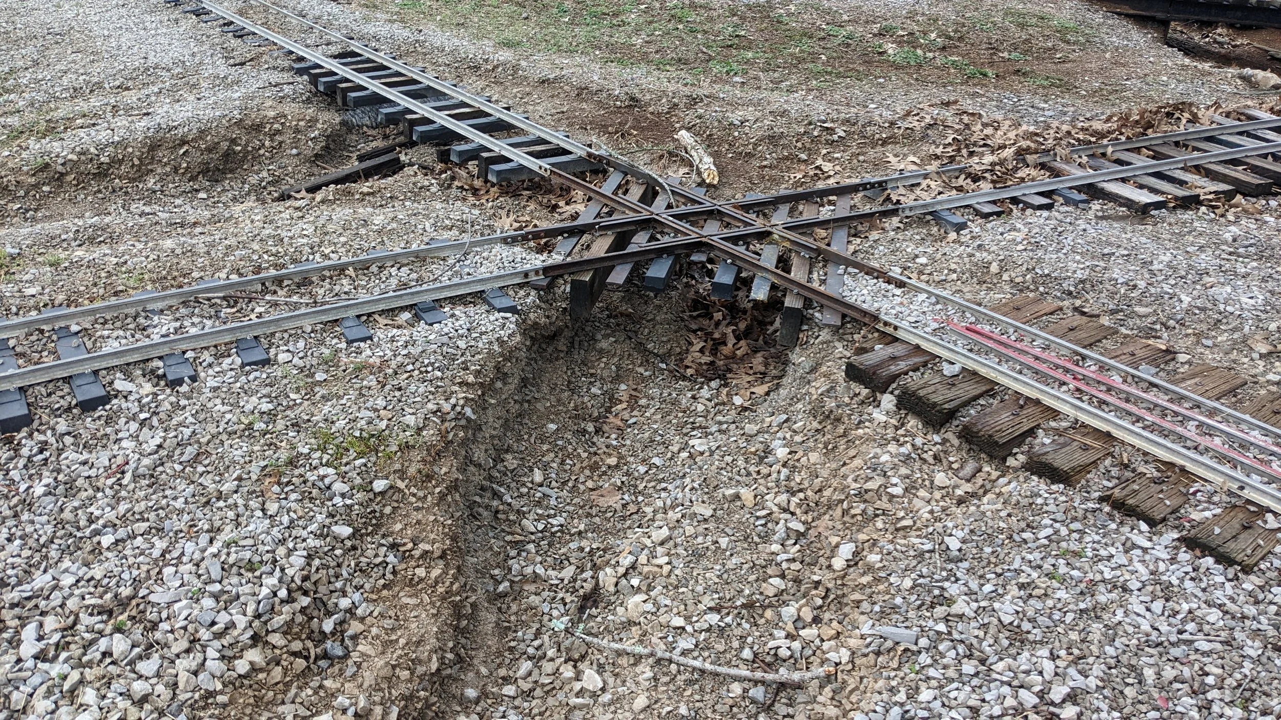
Area #1
This is where the track crosses the walking path. We are not sure what changes have been made further up the hill (towards the street side) but we have noticed an increased amount of water flow in this area.
All this water is now flowing down the walking path instead of the culberts.
March 27, 2021
Area #2
This area is being affected by at least a few issues. Issues one is related to the increased water flow from Area #1.
After the new water line was installed at the park (between White Oak and Kids Kingdom Bathrooms in Feb of 2016) The water no long flows in the paths we created in 1998.
Oringal Ditch near Area #1 that flows down hill
Water flow from area #1 down the hill - area #2 is to the right in this photo - Circa 1998
As you can see below, the original design of the bridge was to catch any water that came down the field in one of two bridges. With the grading changes from the water line install, this water is now being pushed onto the walking path and then onto the track, further down then it was previously.
1998 2nd Bridge install to catch water from area #1. Other bridge is located to the left of this photo.
There is additional rainwater coming from the hill where the station is located, and the bathrooms, all converging on the walking path and then down to the same area, just compounding the issue.

March 3, 2023 - Washout from water flow
March 3, 2023 - Washout from water flow
May 5, 2018
Sept 24, 2018
Area #3
So, this brings us to Area #3. Additional water from the field (below dog park) and white oak parking lot all converges at this point into the creek bed. The blue arrows indicate where rainwater has been observed to flow. The red line is another drainage ditch, but nothing seems to make it that way from our side. At one time, there was flow, as the park had to install riprap in that ditch to prevent continued erosion.
The grate pictured here is connected to a line that runs into the creek next to us as well. You can see the “berm” along the fence line that pushes all rain water down the walking path and towards the creek.
As you can see from these videos, the creek bed just can’t handle the volume of water that is being pushed down to that area.
mAY 2009 - 4.5 iNCHES OF rAIN
mAY 2009 - 4.5 iNCHES OF rAIN

September 24, 2018
March 27, 2021 - This was during a flash flood but it shows how much of the water from the area flows into the creek next to our facility.
Sept 21, 2021 - After a light rain, creek is almost full
In Summary: We are aware that no one can account for flash floods or the odd storm that dumps water everywhere in the park. These rain water flow issues affect us every season. The water just can’t get out of the area fast enough and does not flow down correct channels as they are gone or not been maintained.
We look forward to working with you Al to get these issues addressed in the future.